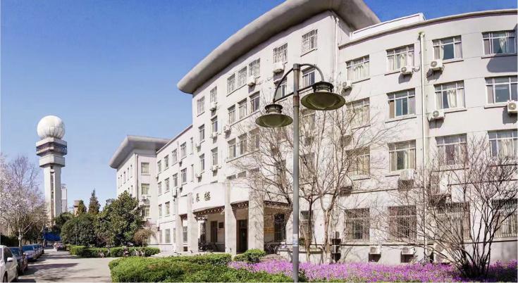
School of Geographical Sciences
Introduction
The School of Geographical Sciences (SGS) originated from the Department of Climatology established by Nanjing Institute of Meteorology in 1960. Over years of construction and development, the School of Remote Sensing was established in 2006 and renamed as the School of Geography and Remote Sensing in 2014. From November 2017, the School of Geographical Sciences operates independently with three bachelor’s majors of Physical Geography & Resource Environment, Human Geography & Urban and Rural Planning, and Geographic Information Science (GIS) , two master’s degrees of Geography, and 3S Integration and Meteorological Application, and two PhD degrees of 3S Integration and Meteorological Application, and Surface Layer & Process.
SGS has a fine environment and advanced facilities for teaching and research. Several research institutions have been established here, such as the “National Space Infrastructure- Nanjing Authenticity Inspection Station” , the “Remote Sensing based National Engineering Lab- Nanjing Research Center” , Jiangsu Engineering Research Center for Intelligent Applications of Geographical Big Data, Jiangsu Ecological Environment and Green Development Institute, Disaster Risk Management Research Institute, Land Science Research Center and “Belt and Road” Research Center for Urban Sustainable Development, 3S Integration and Meteorological Application Laboratory, GIS Technology And Application Laboratory, Jiangsu Remote Sensing Application Experimental Teaching Center, etc.

Faculty
SGS has 84 faculty members, including 66 teachers. Among the teachers, there are 15 professors (including 4 level-2 professors), 22 associate professors, 12 supervisors of doctoral degree candidates, and 44 supervisors of master’s degree candidates. All teachers under 50 years old are doctoral degree holders. Some of our teachers are foreign academician, experts entitled to Special Government Allowance from the State Council, Humboldt Fellowship, Marie Curie Fellowship, Distinguished Professors of Jiangsu Province, experts of the Program of Innovation and Entrepreneurship of Jiangsu Province.
Research
SGS is renowned for its pioneering research on meteorological GIS, geographic process modeling and remote sensing, 3S integration and meteorological application, global change and regional response, disaster risk management, urbanization and sustainable development, etc. From 2018, the school has undertaken more than 40 national scientific research projects, four of which are key projects. The staff in SGS has published more than 400 academic papers, some of which are published in top-notch international journals, such as Nature Communications, Nature Plant, Science Advances, PNAS, BAMS, ESR, ESSD, Earth’s Future, etc. Also, some teachers won noted prizes like one first-class award of Natural Science in Xinjiang Autonomous Region and one second-class award of Natural Science in Jiangsu Province. Nearly 30 patents are granted during the past 5 years.
In order to build the school into a well-known and influential geographical college in the world, SGS actively expands cooperation and exchanges at home and abroad. We have conducted extensive cooperation and exchanges with universities and scientific research institutes in major countries and regions like USA, UK, Germany, Australia, Netherlands, Poland, etc. We also invite experts home and abroad to give lectures for our students and staff members, and select full-time teachers to exchange with relevant universities and institutions.
Degree programs
Bachelor’s Degree (4 years)
Physical Geography & Resource Environment
Human Geography & Urban and Rural Planning
Geographic Information Science
Master’s Degree (3 years)
3S Integration and Meteorological Application | Acquisition and Remote Sensing Monitoring of Surface Environmental Information |
Global Change and Regional Response | |
Natural Disasters and Assessment | |
GIS Software Development and Visualization | |
Remote Sensing of Natural Resources and Environment | |
Geography | Physical geography |
Human geography | |
Cartography and geographic information system | |
Remote Sensing of Environment | |
Environment and disaster geography |
Ph.D. Degree(3-6 years)
3S Integration and Meteorological Application | Land Surface Process Simulation and Remote Sensing |
Remote Sensing of Natural Resources and Environment and Global Change | |
GIS Technology and Meteorological Application | |
GNSS Remote Sensing and Meteorological Application | |
Meteorological Disaster Monitoring and Assessment | |
Earth Surface System | Earth surface observation and data assimilation |
Surface processes and modeling (including urban landscape pattern and process) | |
Climate change risk and adaptation |
Contact us:
Administrative Office:
Address: Beichen Building No. 219, Nanjing University of Information Science & Technology, Nanjing, China
Tel: +86(25)58731191
Email: yuhzhang@nuist.edu.cn